
Where Space and Wildfires Interconnect
When we think of Space, our thoughts gravitate to the mysteries of the universe and if humans really will be able to live on Mars. Last month, Christina Gerakiteys, co-CEO at SingularityU Australia moderated a “Future by Design” virtual event with Dr. Alex Held Director of CSIRO’s Center of Earth Observation and AquaWatch Australia Mission and Co-Lead and Co-Chair of the Committee on Earth Observation Satellites SIT; Justin Leonard, Research Scientist with CSIRO Bushfire Adaptation; and Susan Lucas-Conwell, Executive Vice President of the CSIRO US office as discussion guests.
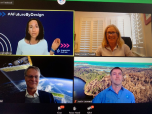
Christina Gerakiteys, SingularityU Australia, Dr. Alex Held CSIRO’s Center of Earth Observation, Justin Leonard CSIRO Bushfire Adaptation; and Susan Lucas-Conwell CSIRO US.
Dr. Alex Held, shared that, “Space is a great vantage point from which to observe the processes of Earth.” Space helps us gain a broader and more in-depth understanding of the potential impacts of our planet’s changes. The macro-view knits together the results from multitudes of individual science projects conducted around the world conducted by citizen scientists and researchers.
With over 250 instruments in space measuring various Earth attributes, the data is used by multiple applications that drive management decisions and new scientific insights. NASA uses earth observation data for situational awareness of fires and hurricane tracking. Meteorologists use real-time satellite data feeds to maintain up-to-the-minute weather forecast models. Through longitudinal analysis of data from a Japanese satellite, the Australian continent shifts about 7 centimeters every year.
Justin Leonard shared an insight presentation titled “Bushfire Planning Hazard Mapping” with the audience and his broader research work around the understanding of how wildfires impact various types of infrastructure at the local scale. Justin discussed how earth observation data is instrumental in understanding wildfires and informing urban design.
We will never eliminate wildfires, they are a natural and essential part of nature. Longitudinal data enables city planners to understand how their policies and building decisions impact wildfire risk. That same spatial mapping data helps communities understand and reduce the future losses from wildfires.
Irrespective of geopolitics, the global scientific community frequently collaborates on issues. By sharing best practices, they collectively determine the best approach to a particular issue. The CSIRO DataCube enables the broad use of space observation data. By systematizing all the data streams into a common language and making it open source, anyone can build their algorithms on top of CSIRO’s DataCube to predict, model, forecast and manage wildfires and natural disaster in their part of the world.
Lucas-Conwell reminded everyone there is a renewed global appreciation for scientific research. The general public is “having the ‘ah-ha’ moment in the role and essential need for foundational research” by seeing the application of science into their daily lives and products they use.